The Jiayang National Mining Park: Walking the Line

The Jiayang National Mining Park of Sichuan: Walking the Line
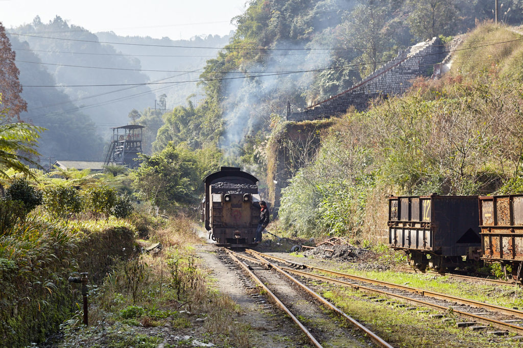
The Jiayang Mining Group was a Sino-British joint venture formed in 1938 to tap the rich seam of coal that ran under the mountains in Qianwei County about 180 kilometres south of Chengdu. A railway was built to haul the coal from three separate mines to the Minjiang River at Xishi. Only one of the mines remains operational but the steam hauled railway, which serves the small mining communities that grew up along its route, is still running. Set in the glorious Sichuan countryside it forms the backbone of what is now the Jiayang National Mining Park.
In addition to the scenery, the ride takes you through sleepy little red brick towns frozen in time where the, mostly elderly, residents sit chatting in the shade of tall trees or keeping an eye on grandchildren whose parents are away working in the city.
Riding the trains is a must. It’s the only way to get in and it is indeed a fun journey. But the best way to enjoy the lush greenery of the countryside through which it passes is to get out and walk. There is a well-worn motorcycle path by the side of the tracks and even if you decide to hop the unevenly spaced sleepers there is no chance of being hit by a train. You’ll hear its whistle echoing around the valley long before it gets close.
It is possible to walk the entire 19.8 kilometres of the line in a day but breaking it up into sections allows you to dawdle and detour to your heart’s content.
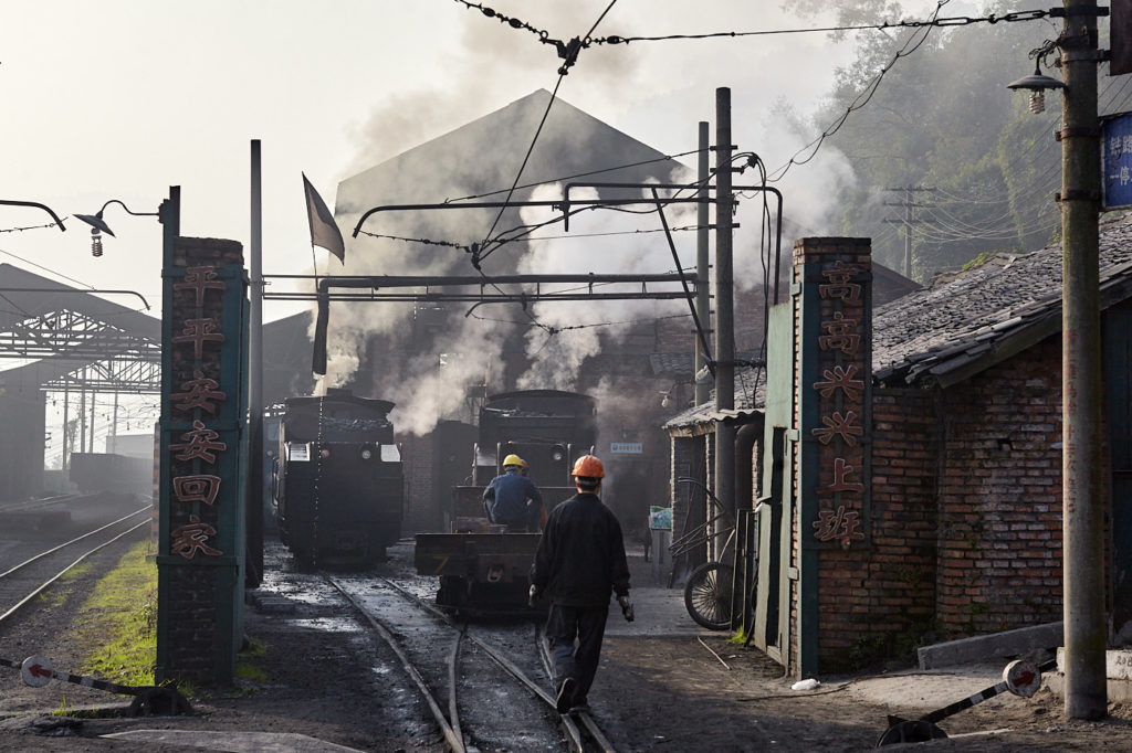
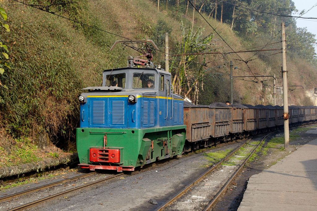
The steam locomotive shed at Xishi (left). Coal from Number Three pit at Yeujin arrives at Xishi.
The end of the line is at Xishi, a small town that clings to the hillside above the Minjiang River. This is where the coal is delivered, originally for transportation along the river to supply the Chongqing Iron and Steel Works. These days it is all used in the power station at the end of the line for generating the region’s electricity. It is also where the railway maintenance depot is located.
Whilst the mines at the far end of the line have closed the one at Yuejin, one stop along, is still producing coal. This 4.4-kilometre section of the line has been electrified and is quite busy, with burly looking blue and green blocks of motive power dragging trains of forty or more coal trucks. Their strength is impressive but they lack the charm of the steam locomotives panting and wheezing under the strain.
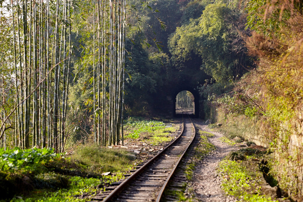
From Xishi station turn right along the tracks. The railway mostly follows the road but cuts a corner off in order to go through the mountain instead of around it. The tunnel required to do this is the first of six and is 175 metres in length. Many of the locals are happy to stroll through tunnels without a lamp but even with daylight at both ends the middle is pitch dark. It does help to have a small torch if only to see where you are putting your feet. If a train is imminent a red light will be on to warn pedestrians and motorcyclists to wait.

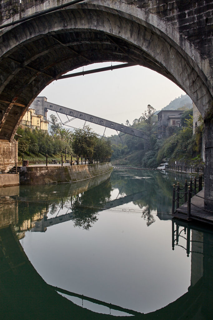
Loading coal into the wagons at Yuejin ready for the journey to Xishi (left). Looking down the river towards the colliery.

Fishing is a team sport in Yuejin, but the fish always seem to get away.
After the tunnel the line veers south towards the town of Yuejin. This is where the No 3 pit and the Jiayang Group’s headquarters are located. It is also the official entrance to the Jiayang National Mining Park.
The centre of town isn’t particularly interesting but below the station is a small river where, on a sunny afternoon, fishing is the thing to do. Here it is not the solitary pastime that is the norm in other places but more of a community activity with barely an arm’s length separating the fishermen. Nobody seems to catch anything. The fish always get away drawing gasps of disappointment from the onlookers. A footpath along the river and a few stepping-stones offer a brief but pleasant stroll in the shadow of the colliery buildings and an old residential area on the far bank.
Back up on the railway, coal is being loaded into the wagons for the journey to Xishi. The loaders are still operated by hand with the train moving down a truck at a time until all are full. It’s quite hypnotic watching the cascades of black coal tumble into the trucks and it is also impressive how fast several tons of coal can be loaded.
Into the valley
From Yuejin the line starts to climb the side of the valley. For a while, the line is reasonably straight but after about three kilometres it begins to meander. Just along here is an area called Yueliangtian, or Crescent Field, which takes its name from the shape of the terraced fields by the side of the track, which is enclosed within a large curve. There is supposed to be a path from here that leads down into Xianren Canyon through a forest of Spinola and bamboo to a village called Shuixing, which dates back to around 1860. However, nothing is marked and there are no maps. There are numerous paths from which to choose, most of them existing to provide access to fields or facilitate the collection of bamboo. Searching for the trail would be a worthy hike in its own right but there wouldn’t be an opportunity to rejoin the railway until much further up.
From Yueliangtian the line snakes its way to the first station at Mifengyan. This is approximately halfway along the railway. There are no turntables on the line so from Shixi to here the locomotives will run tender first. Mifengyan is a kind of Y-junction. The locomotive uncouples from one end of the train, runs around, and couples onto the other to continue its climb.
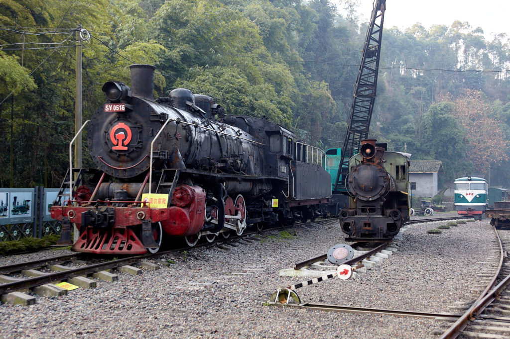
The railway museum at Mifengyan.
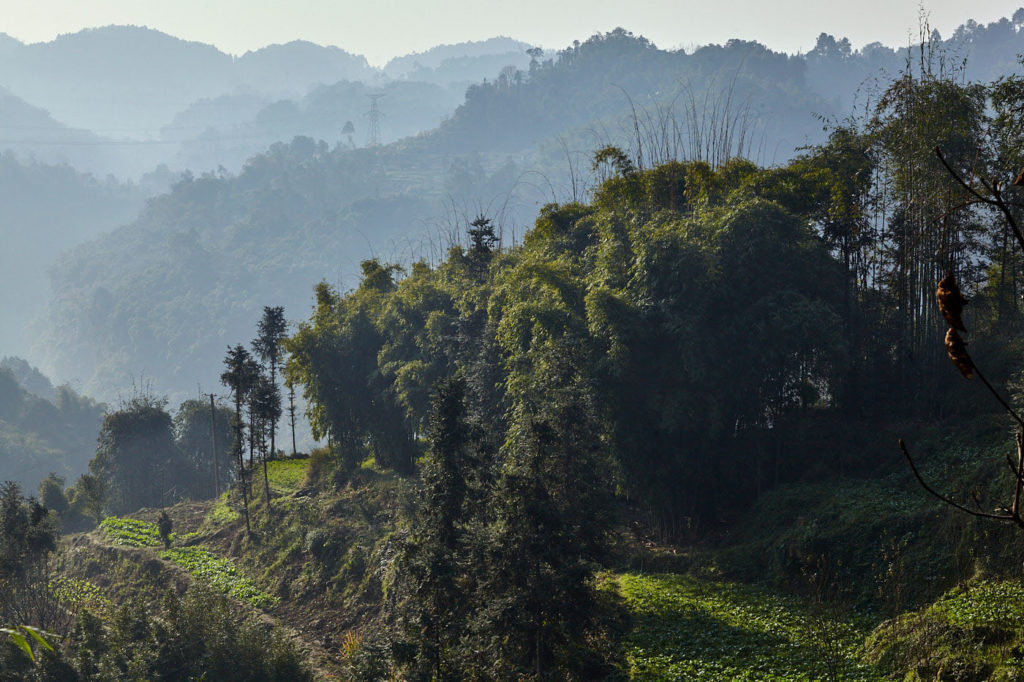
Hazy but breathtaking vistas. There are footpaths that lead down to the valley. There is bound to be something awesome waiting to be discovered (left). On the other side of the line, there is a wall.
There is a small railway museum at Mifengyan that features a few old locomotives and some exhibition panels detailing the history of steam. Sadly it is open to the elements and the exhibits have suffered the consequences. Furthermore, the example of the locomotives that still work on this line looks like it has been plundered for spare parts.
Leaving Mifengyan the line wends its way past places with names like Duan’s Bay (Duanjiawan) and Monk Bay (Heshangwan), which boasts the steepest gradient on the line. Old Eagle Beak (Laoyingzhui) is so-called because it apparently looks like one, although it’s difficult to see from the vantage point of a hiker. What is noticeable are the cliffs to the right and the rather steep drop to the left. Beyond the drop are hazy but breathtaking vistas which make me think of old Chinese watercolours. There is also a tunnel, which at just 49 metres is the shortest on the line. Beyond this, the line follows a huge arc to the left as it climbs towards Caiziba.
The name means Rapeseed Dam and if you are fortunate enough to be there in spring the terraced fields are lush with the golden flowers of the plant from which the name is taken. A path on the right to the west of the station leads to a small village. Follow the road back to the north for a few minutes and you will be rewarded with more breathtaking views of the surrounding countryside.

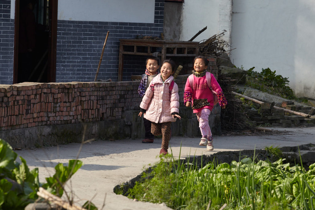
Pensioners relax on the road through Caiziba (left). Free from lessons children run to the station to wait for the train home.
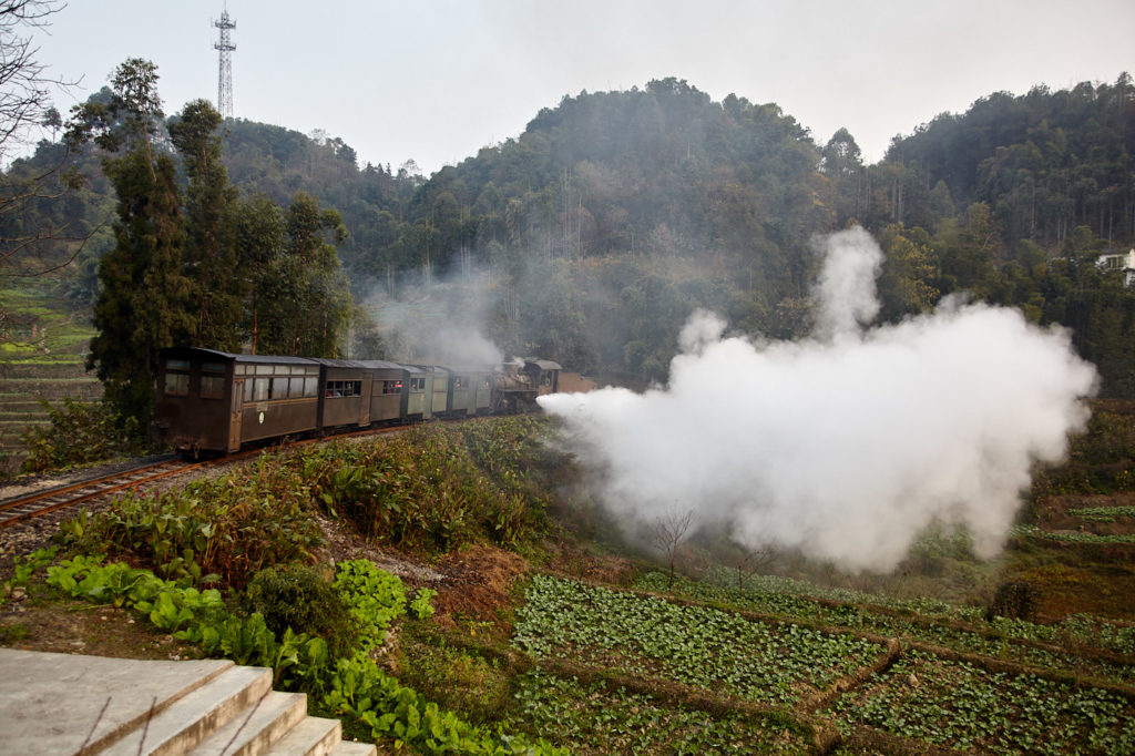
The locomotive lets out a blast of steam as it heads down the Caiziba loop towards Yuejin.
Although the village has only a dirt road, many of the houses look new and well maintained with solar panels furnishing the rooftops. There is also a school nearby from which, just in time for the afternoon train, children spring forth. A lone foreigner on the platform is an excellent source of entertainment. And it is well worth being on the platform to watch the trains as they laboriously pant and wheeze their way up the hill or let off a huge jet of steam across the fields as they make their way back down.
From Caiziba there is a long straight after which the wide-open vistas close in and the line passes through a series of cuttings. The first is shallow and mossy, about 4.5 metres (15 ft) high, followed by a much deeper cutting draped with ferns. The incline, which may have been steep for a train but has never been more than gentle for a sturdy pair of boots, starts to level out.
Xianrenjiao is, at 602 metres, the highest station on the line. The original station buildings are still intact though somewhat dilapidated. There are a few houses and some sausages hung out by the side of the line to dry. This is the other end of the reputed Xianren Canyon trail but, as before, there are no clues as to where the path actually is.
Shortly after Xianrenjiao, the line plunges into the first of two tunnels. The first is 104 metres; it is curved and the light at the other end doesn’t appear until you are a little way through. There is a smooth concrete path along the side but there is also a narrow drainage ditch between it and the wall, just wide enough for a careless foot, so that the torch really comes in handy.
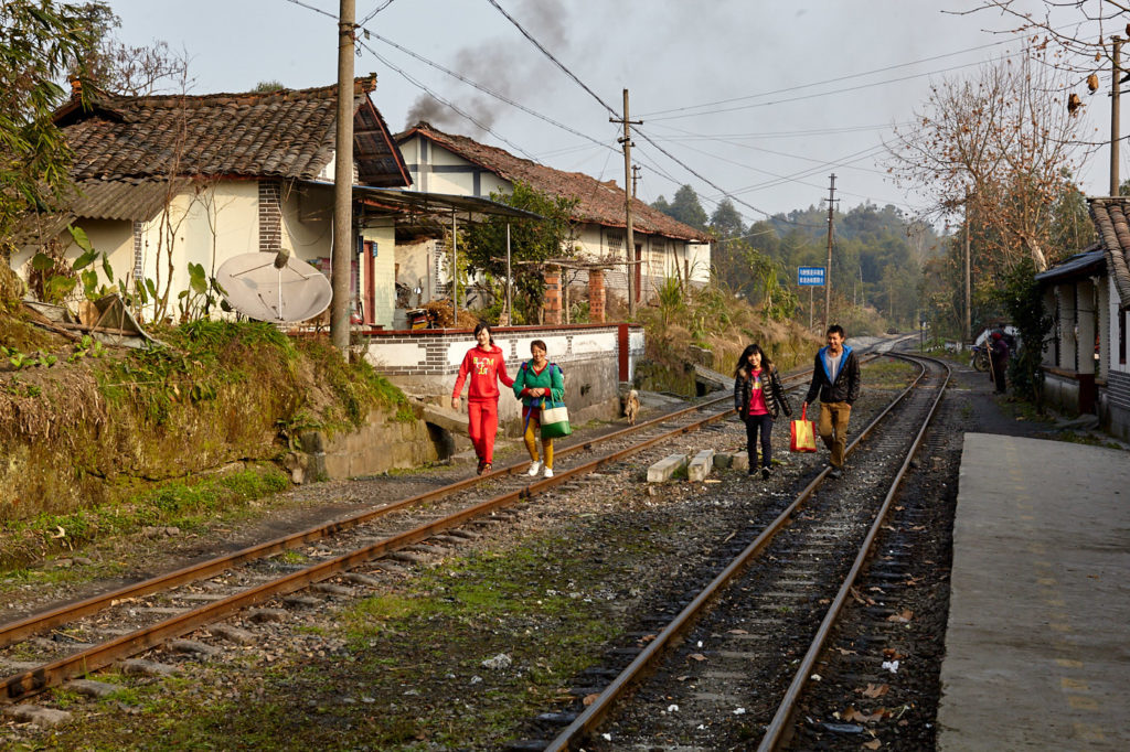
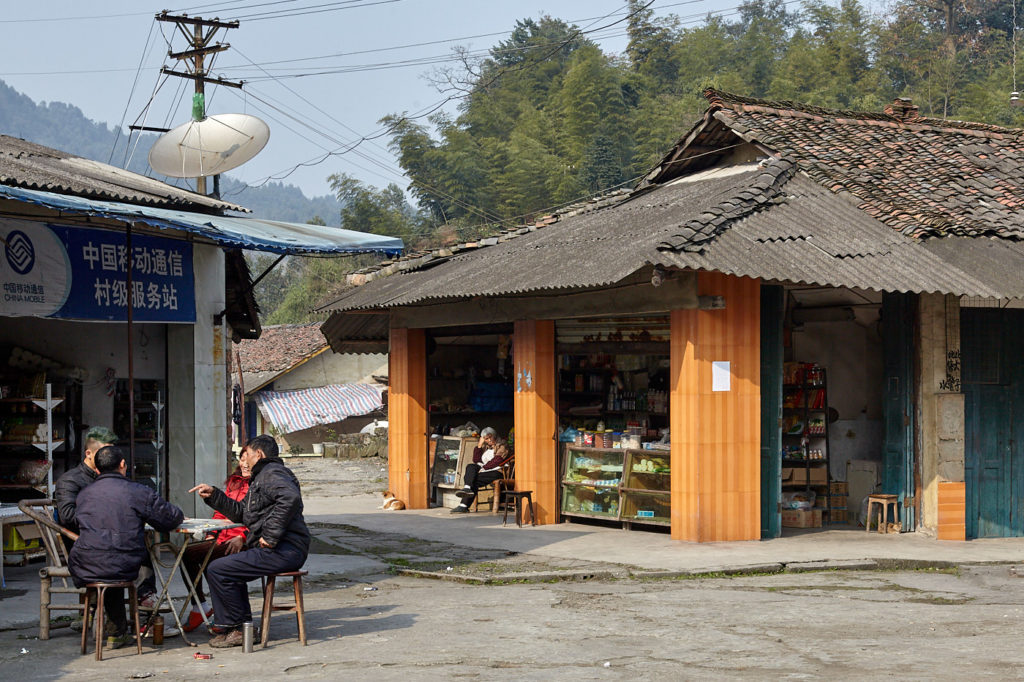
Xianrenjiao station is the highest point on the line (left). Catching a little sunshine while playing cards in Jiaoba’s town square.

Old disused industrial buildings at Jiaoba.
The other end opens into a narrow, steep-walled cutting covered with ferns and trees (main picture). Here the air is still and alive with birdsong. The cutting is about 80 metres long and the only other way into and out of it is another tunnel at the far end. This tunnel is 127 metres and straight. From here the line passes a small dam and reservoir on the right before rolling into the old mining town of Jiaoba.
This is the location of the Jiayang Group’s No 2 pit. The mine was closed in 1988 and most of the population moved away. Many of the buildings remain intact and the coal loaders are still in place. Up in the main part of the village retirees while away the afternoon playing cards, and dogs, woken from their snooze in the sunshine, grumble at passing strangers.
From Jiaoba it is only 1.4 kilometres to Bagou and a large percentage of that is in the tunnel. Leaving Jioaba past the old coal loader there are some cottages on the left and some fairly dense bamboo on the right. After a long straight the line bears right past a quarry and into the first of two tunnels. Both tunnels are 224 metres in length, the longest on the line. This one is straight and there are a few lamps to illuminate the way but the light is weak and doesn’t help much.
Between the tunnels, there is a rusty truck and a head-shunt, some interesting old British-style buildings and fields that tumble down a pleasant wooded slope. The last of the tunnels is the gloomiest on the line. There is a sharp curve at the far end so most of the walk is in darkness with water dripping from the walls and roof.
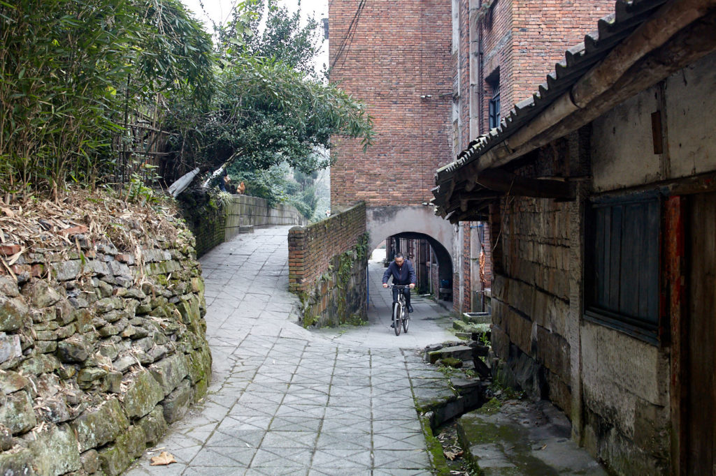
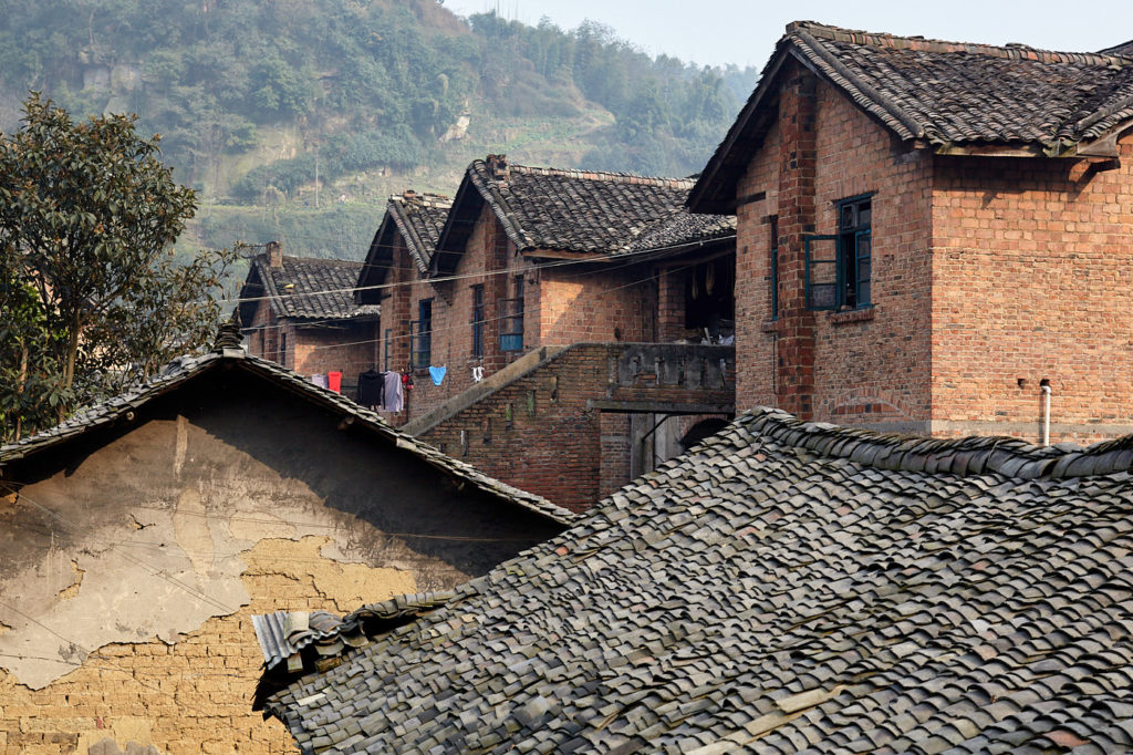
Life progresses at a leisureley pace in Bagou (left). Many buildings are still occupied but many others could easily be restored and turned into accommodation for tourists.

Rattling towards Huangcun, the train passes the roofs of old miners’ cottages in Bagou.
The exit leads directly onto Bagou station. The original station buildings have gone and been replaced with a rather tacky pseudo-alpine-looking affair, the back of which appears to be a hotel although the gates were locked.
A huge auditorium built for the workers occupies the centre of town, and outside old lathes, drills and other bits of industrial machinery lay rusting. Adjacent is an open area shaded by towering dawn redwoods. The Soviet style administrative building, which now houses a geological and mining museum, takes up the far side.
Beyond the auditorium is the town square at the end of which is a restored stage where notorious “struggle sessions” once took place. These days the only struggles are the nightly aerobics classes that help keep the mostly retired residents fit.
Zhongfu Street is one of the oldest thoroughfares in town. It was once a street of opium dens, brothels and casinos. It still thrives each morning as a market for local farmers to sell their produce. But many of the other buildings around town, from humble miners’ cottages to schools and hospitals, are empty now and are falling into disrepair.

Old miners cottages between Bagou and Huangcun.

The line ends at Huangcun and the No. 3 pithead (left) but there are intriguing footpaths beyond for those with a little time and a sense of adventure.
Huangcun is the final stop on the line and the site of the original mineshaft. There is another small museum here and the shaft itself is sometimes open to visitors, though this seems to be a seasonal thing. Even if the shaft is closed it is still worth the hike for the Cultural Revolution murals and slogans that adorn the walls of the buildings. Huangcun is little more than an extension of Bagou so if you are staying in town it is pleasant to stroll back alongside the small river and the plantain groves.
Walking the line is only one of the hiking opportunities in this area. The search for Shuixing Village still beckons and there are inviting paths around and above Bagou and into the narrow valley beyond Huangcun. The fact that there are no maps or signposts only adds spice to the adventure.