Hiking in Hong Kong: Exploring the waterways of Tai Tam
Exploring the waterways of Tai Tam
One of Hong Kong’s best-kept secrets is its impressive network of hiking trails. It is hard to imagine, when you are strolling around the shops and malls of Tsim Sha Tsui or Causeway Bay, that of the territory’s 110,400 hectares, 43,455 of them, or around 39 percent, are protected country parks.
For the visitor, though, these are not always easy to find. The city’s architects and tycoons have seen to it, as far as possible, that when you emerge from an MTR station, you do so into a shopping mall. Most of which look the same and none of which give you a clear indication of how to get out of the wretched thing.
It is true that for many of the country parks you do need enough inside knowledge to navigate the minibus services, but for others, you just need to know where the exit is.
Related: Stroll along the Tai Tam West Catchwater
Related: Hiking at Big Buddha and the Wisdom Path
One of the easiest to find and, in my opinion, one of the prettiest on Hong Kong Island, follows the access roads that were built towards the end of the 19th century to serve the Tai Tam reservoir system. My favourite route starts at Mt Parker Road near Tai Koo MTR station and winds its way upwards and through Windy Pass, the saddle between Mt Butler and Mt Parker, before starting a gentle descent through the forest towards the reservoirs.
Take the MTR to Tai Koo and leave the station via Exit B, turn left into Kings Road and walk along for about 300 metres. Take the third turning on the left into Mt Parker Road, just before the footbridge.


Climbing Mt Parker Road you soon leave the city behind (left). It is a popular stretch for people to enjoy an early morning walk
As you turn your back on the roar of Kings Road you will notice a small row of shops on a side road to your left. If you haven’t already done so it is a good idea to grab a bottle or two of water. There is a steep climb ahead and this is the last chance for a few kilometres.
The climb starts quickly between the municipal market building on the left and a small Taoist shrine on the right. The path is steep but this is still officially a road and while motor vehicles are scarce they do come along from time to time. Soon joggers, people walking their dogs, and pensioners out for a morning stroll with small radios tuned to Chinese opera or the day’s morning news will join you. Along the way, they will meet friends and neighbours and stop for chats at one of the many resting places.
Towards Windy Gap
As you climb, the din of the city drops away and it won’t be long before the tall buildings that dwarfed you a short while ago in the street begin to look rather small, and you can see over the tops of them to the harbour beyond. On a bright morning, the sun will have risen over the eastern end of that harbour, bathing the green hillsides in light that, in summer, will be alive with the courting song of frisky cicadas.
Up ahead the tops of two mountains come into view. To the left, Mt Parker with its two radar stations, and to the right, Mt Butler. Between them is Windy Gap, through which the road passes. There are some toilets here and a small pavilion to sit for a moment and take on water. There are fewer people now and most of those that have climbed this far will be turning back.
To the left, a branch of Mt Parker Road continues up to the summit. Right behind the pavilion is a long flight of steps called Jacob’s Ladder, which marks the end of section five of the 50-kilometre Hong Kong Trail. Section six joins Mt Parker Road as it starts to wind its way down the other side.
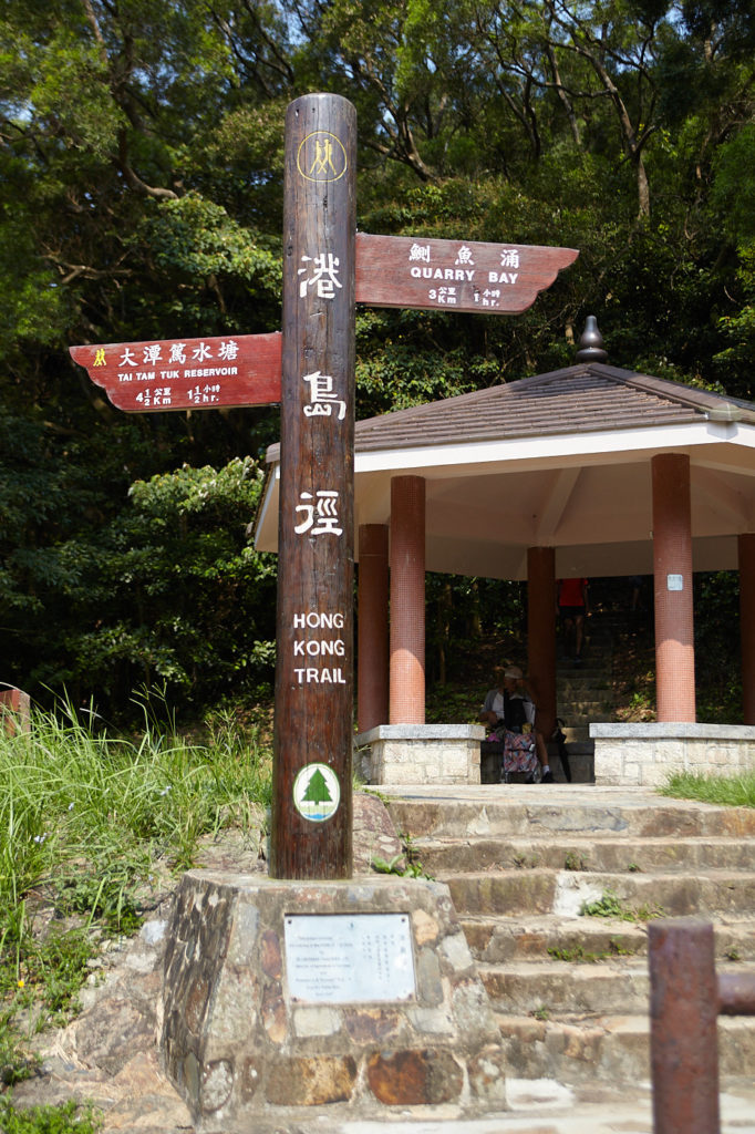
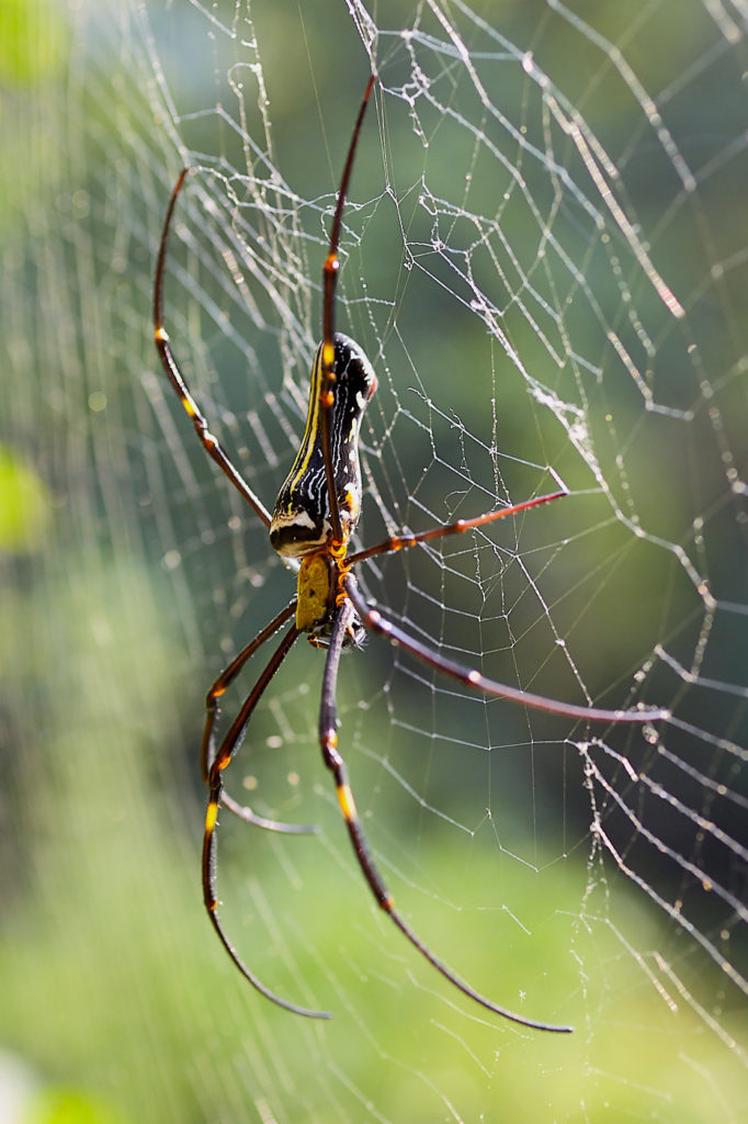
The pavilion at Windy Gap where Mt Parker Road meets the Hong Kong Trail (left). Golden Orb Weavers (Nephila pilipes) are a common sight from late May through to the end of July
After the hot climb up, the start of the journey down is through a delightful tunnel of tall, broad canopied trees that provide welcome shade. Between late May and early August, you should be able to spot plenty of Golden Orb Weavers (Nephila pilipes) next to the path. When mature these majestic spiders can weave webs that are up to 1.5 metres (5 feet) in diameter, and which shimmer with a golden hue in the sunlight.
If you’re quiet and lucky you might catch a glimpse of the fiery red abdomen of a Pallas’s Squirrel as it darts among the branches.
The path meanders its way down towards Tai Tam Upper Reservoir. At one turn a clearing in the vegetation provides a stunning view south over the Tai Tam Tuk dam towards Red Hill. A little further the hillsides to the west come into view along with the brick-red tops of the luxury residential complex Park View sticking up like two lost bits of Lego. The trail continues in a straight line down to the edge of the reservoir and the end of the dam.
Mt Parker Road and the Hong Kong Trail diverge at this point. The road continues straight ahead. It is possible to continue this way and meet up later but following the Hong Kong Trail across the top of the dam is much more rewarding.
A grand water scheme
The Tai Tam reservoir scheme was built between 1883 and 1918 and encompasses four reservoirs and five dams. Due to overpopulation in the central and western areas pressure had been growing to open up the eastern end of the island, but to do this a fresh water supply system would be needed. In 1873 the Government’s Surveyor General, John MacNeile Price, put forward what was said to be “the grandest water scheme of its day.”
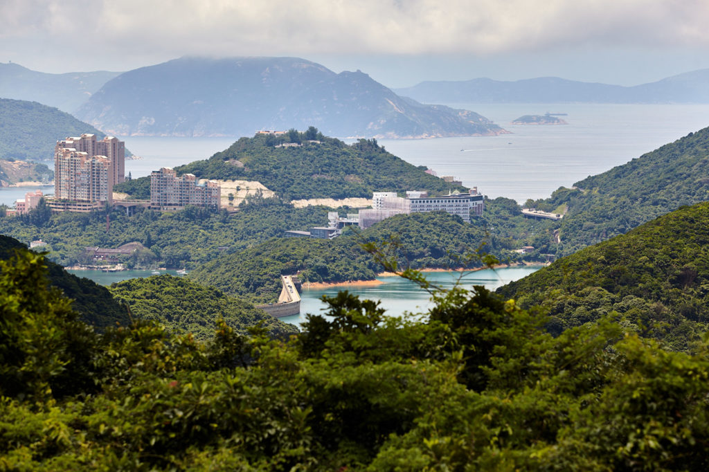
The view across Red Hill with the Tai Tam Tuk Reservoir dam just left of centre.

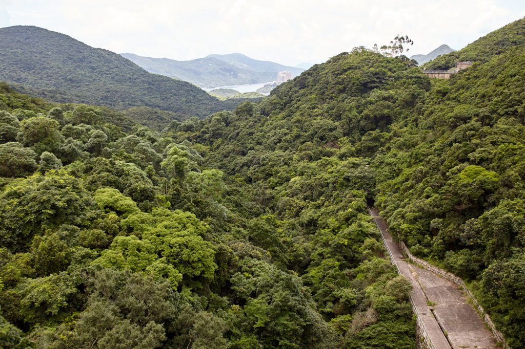
The Tai Tam Upper Reservoir dam with unique terracing on the south face (left). The view across the Tai Tam Valley
The Tai Tam Valley clearly offered a huge water catchment area with plenty of room for future developments as and when they were needed. The major drawback, however, was that it was on the other side of the Wong Nai Chung mountains to where the water was needed. Price’s solution was to dig a tunnel through the mountain which would connect to an aqueduct that followed the contours of the hills above Wanchai and feed the storage tanks that were at the top end of what we now know as Cotton Tree Drive. Unfortunately, an economic recession followed by a typhoon in September 1874, which killed an estimated 2,000 people and wrecked the city’s waterfront, forced the plan to be put on hold.
It was eventually given the green light in 1883 and work commenced on the Tai Tam Upper Reservoir. The dam over which our trail passes was the largest in Hong Kong at the time, at 30.5 metres high, 122.9 metres long and 18.3 metres wide at its base. When it was built it could hold up to 1.1 million cubic metres of water.
The structure at about 45 metres across is the valve house that, like the rest of the dam, is concrete surfaced with granite blocks. The work was completed in 1888. From the middle of the dam, the view across the forest-clad valley rolling down towards the sea is quite breathtaking. The terracing on the front of the dam is unique and a flight of steps on the far side followed by a short walk will lead to the recorder house, added in 1917 to monitor the flow of water.
The hardest part of the system’s construction was digging a 2.2-kilometre tunnel through a granite mountain, which required with the rudimentary tools available at the time, a huge amount of physical labour. When complete the inlet was finished with a neo-classical archway. The recorder house encloses the tunnel inlet, which although it is still in use to this day, is not visible to the public.
The five-kilometre aqueduct, which was named Bowen Aqueduct after Sir George Bowen, Governor of Hong Kong from 1883 to 1885, is now Bowen Road, a popular jogging and dog walking trail in its own right.
The section that follows the reservoirs is called the Tai Tam Waterworks Heritage Trail. Turning left at the end of the dam and following the water’s edge brings us to a small bridge and a small masonry aqueduct. The job of this aqueduct is to carry water collected from the West Tai Tam catch-waters and funnel it into the reservoir. It is possible to walk across the aqueduct and follow the catch-water, but that is a different hike altogether.

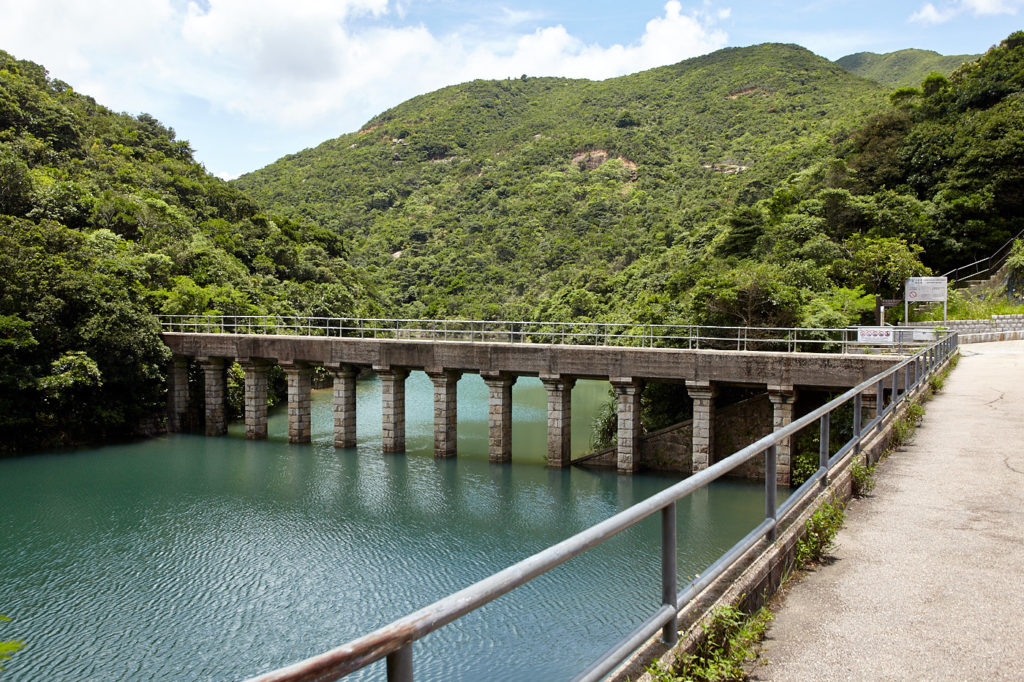
Along the side of the Byewash Reservoir. The little footbridge (right) is actually an aqueduct carrying rain from the West Tai Tam Catchwater to the reservoir.

Oriental garden Lizard
It is also at this point that our trail meets Tai Tam Reservoir Road, which leads down from the Hong Kong Parkview residential development, the Lego blocks that we saw earlier. Following the water, we come to the Byewash Reservoir dam that was built in 1904 to collect the overspill when the upper reservoir is full. At the far end of the dam, there is a barbecue site and some exercise bars. The burbling of the water is a constant companion along the next stretch, although you don’t actually see it. Here if you tread lightly you will see lizards and skinks with bright blue tails as well as butterflies flitting amongst the trees.
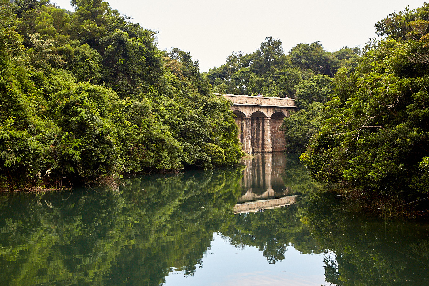
About 500 metres from the dam Mt Parker Road joins Tai Tam Reservoir Road and continues on towards the Tai Tam Intermediate reservoir. You don’t really get a good view of the dam from the main path but just across the bridge, there is a smaller path to the right, which leads to a stilling pond at its base. From here you can also look back and get a splendid view of the granite-clad arches of the bridge (main picture).
The dam and the bridge were built between 1904-1907 but seventy years after completion the spillway of the dam had to be lowered 3 metres for safety reasons. This gives the dam its strange indented crest. Combined with its valve house, built on a separate platform accessed by a steel footbridge, the Intermediate dam is the most distinctive of all.
From here the path meanders along the western side of the Tai Tam Tuk. A gentle stroll passes over three more bridges until, with a rather rude awakening, it spills out onto Tai Tam Road. Tai Tam Reservoir Road continues over the other side of this downhill at the side of the dam to the pumping stations where the old, steam-driven pumps, housed between red-brick walls and a Chinese tiled pitch roof, could push through 14,000 cubic metres of water in a single day.
Turning left at the bottom it is possible to follow the base of the enormous Tai Tam Tuk dam. This final piece of the system was built between 1912 and 1917 and features twelve large spillways to handle overflows. The spillways form arches over which the busy Tai Tam Road connects Stanley and Red Hill to the northern part of the island.

Tai Tam Intermediate Reservoir dam. The crest had to be lowered for safety reasons.


The Huge Tai Tam Tuk Reservoir dam (left). Buses to Stanley or Quarry Bay can be caught at either end.
Climb back up to the road at the north end of the dam. On the right you will see the valve house on a platform set back from the road and finally, at the south end of the dam there is the memorial stone commemorating Sir Henry May, who was Governor of Hong Kong from 1912 to 1918 and who officiated at the opening ceremony.
The entire walk is about 10.25 kilometres. Buses from either end of the dam will take you back to North Point, or to Stanley for a spot of lunch.

Exploring Hong Kong’s New Territories
The New Territories represents around 85% of Hong Kong’s total land area. It is an area of coastal wetlands and mountains boasting a history of more than a thousand years. There are many ancient monuments, well-maintained hiking trails and outlying islands with old fishing communities. Yet to most visitors, it remains largely unknown.
I spent the Covid years researching, writing and photographing it. Exploring Hong Kong’s New Territories is 332 pages with around 400 colour photographs plus maps and directions. More information here
Thanks for this comprehensive and helpful article!
You are welcome, Jennifer
I really enjoyed reading this article just now, Dave.
Your really have a passion for these places and it shines through in your writing.
Why would anybody want to wander the metropolis and shop when they can do that just as easily back home?
To get out into the wider natural and historical areas should be the most obvious thing to do.
Thanks, Russ 🙏. Yes, nature, history and some cool dams and bridges … what is not to love 👍