Hiking to support Lantau conservation
Hiking to support Lantau conservation
Hong Kong’s peak hiking season is here and, with so many people not being allowed to travel abroad this year, the territory’s hiking trails are particularly inviting. For 2020 a new challenge, the UTML or Ur-Trail du Mont-Lantau, is being launched. The name is a cheeky doff of the cap to the UTMB, the world’s biggest trail race, which runs around Mont Blanc.
But the UTML has another motive. With the Hong Kong government keen to push ahead with its controversial HK$624 billion (US$80 billion) Lantau Tomorrow Vision project, the event organisers want to raise awareness about the serious flaws in that vision. The aim is to encourage more Hong Kongers to take to the hills and forests to see and experience for themselves why Lantau is worth protecting. Or at very east enjoy it before it is to late.
The governments plans involve the construction of 1,700 hectares of artificial islands off the south east end of Lantau to build much needed housing as well as infrastructure to promote Hong Kong’s integration into the Greater Bay Area.
Read: Salt, Fish and the Battle of Tai O Bay
Read: Exploring the Waterways of Tai Tam
Critics of the scheme claim that it is too expensive and would devastate marine life leading to smelly harbours for future residents. It will also have a detrimental effect on the lives of local fishermen. The islands would be vulnerable to extreme weather and rising sea levels due to climate change and will be just another concrete eyesore blighting the landscape. There are better alternatives.
The UTMLis a virtual event set to run throughout November. There are nine courses of varying levels to take hikers from the coastal wetlands, through the forests and up to the very tops of the mountains.
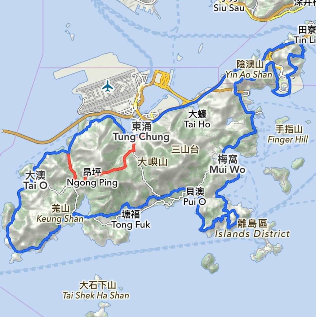
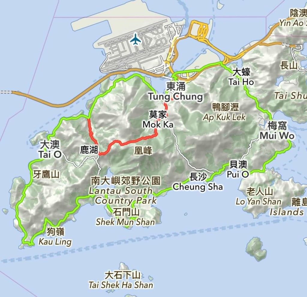
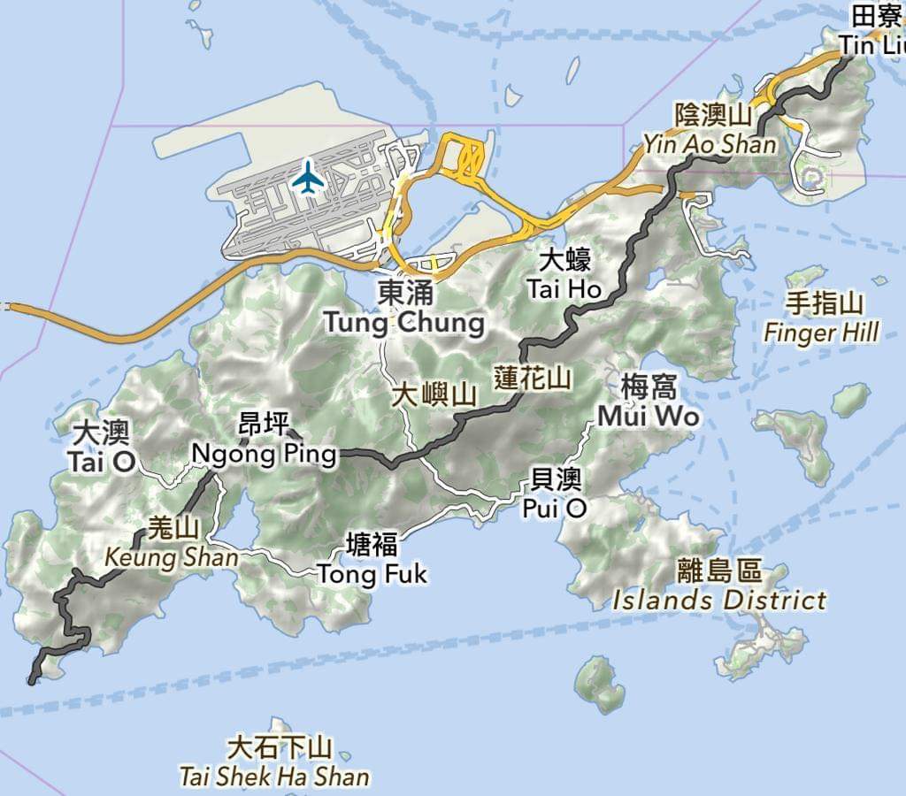
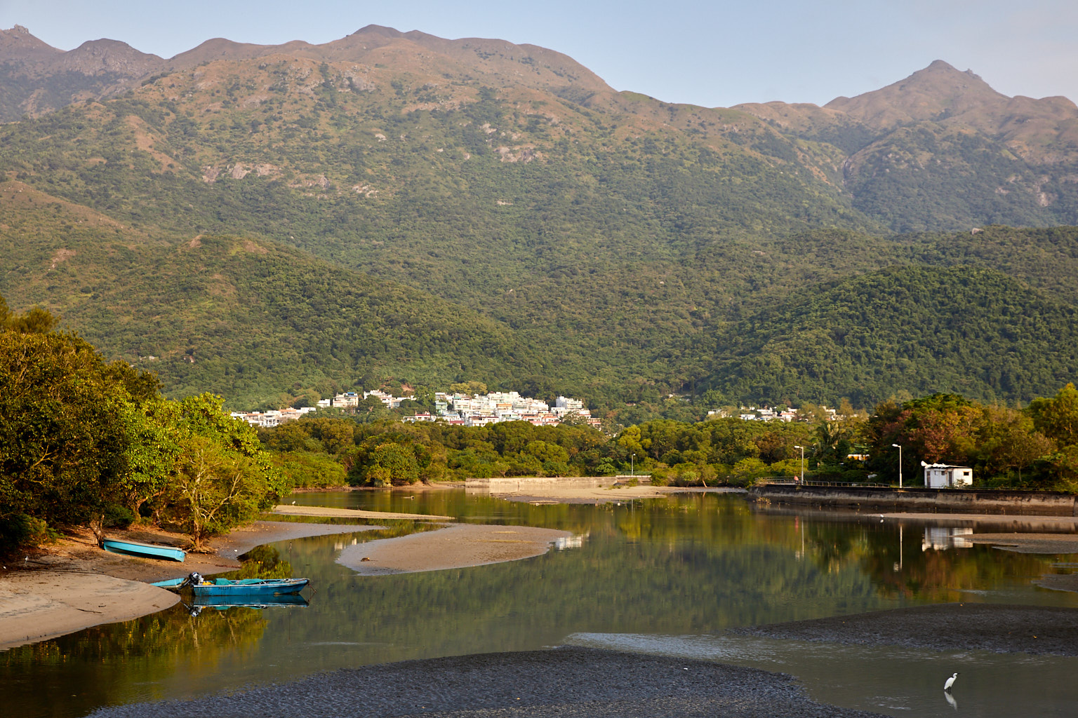
Main picture: The Lantau Major and the Lantau Minor both pass through the Puis O wetlands while the Lantau Dissect follows all the mountain ridges.
The rules
The rules are simple. Use one of the popular smartphone apps such as Strava or Garmin to take the GPS record of your hike. Post a screen capture of it, along with photos, to your Facebook and other social media accounts using the hash tag #HKUTML.
NB Your Facebook post must be public so that it can be counted.
People who are not in Hong Kong are able can follow the routes vicariously. Many of the trails are visible on Google Maps Streetview and those with Google Earth (and a good connection) can download and open the GPX files of the courses.
The hashtags:
#HKUTML (essential) other optional tags are #UrTrailduMontLantau2020 #SaveLantau #ILoveLantau #GoToLantauHKUTML facebook.com/HKUTML2020/ and https://www.instagram.com/hk_utml2020
And the routes:
Route 1️:Lantau Major
The legendary around Lantau route. A great combination of roads and trails. The ultimate test of your physical and mental strength. Gorgeous views of the island and big satisfaction as your reward for completing it.
NB. Because the residents have reportedly blocked access to the trail at Sha Lo Wan Tsuen it is advisable to use the alternative route.
Distance:100KM
Elevation:2900M
Difficulty:✭✭✭✭✭
Main route GPX:https://bit.ly/3lQ0mHT
Alternative GPX:https://bit.ly/3iYdMzP
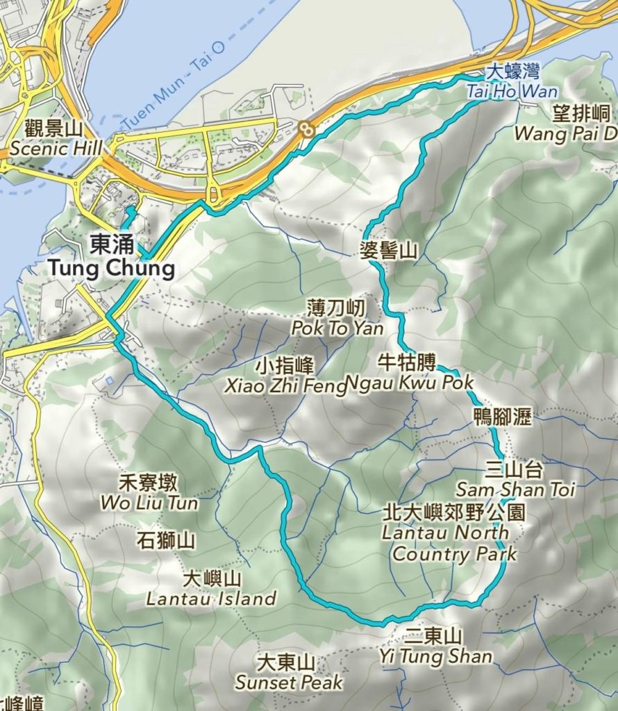
Route 2:Scenic Fish
A photogenic route where you will pass the famous Sunset Peak and many other beautiful hills at the centre of Lantau Island. Keep an eye on you phone’s battery level.
Distance:16KM
Elevation:900M
Difficulty:✭✭✭
Route GPX:https://bit.ly/3nYCKCB
Route 3:Lantau Minor
If the Lantau Major seems a bit much why not try its little brother. You can also participate in the Biji Round Hong Kong: Lantau challenge by running this route.
NB. Because the residents have reportedly blocked access to the trail at Sha Lo Wan Tsuen it is advisable to use the alternative route.
Distance:63KM
Elevation:1300M
Difficulty:✭✭✭✭
Main route GPX:https://bit.ly/2T3RQZn
Alternative GPX:https://bit.ly/3iYdMzP
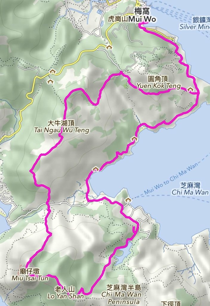
Route 4:Mui Wo Amoeba
Mui Wo to Chi Ma Wan and Lo Yan Shan, then back over the hills. Or the other direction if you prefer.
Distance:16.5KM
Elevation:700M
Difficulty:✭✭✭
Route GPX: https://bit.ly/2TIsSip
Route 5:Lantau Dissect
For people who like to do things the hard way.
Distance:50KM
Elevation:4000M
Difficulty:✭✭✭✭✭
Route GPX:https://bit.ly/31pcV5j
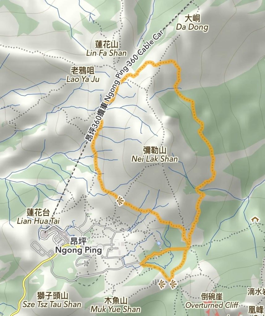
Route 6:Nei Nak Goldfish
Great route for the whole family. Mostly flat and partially shaded. You can enjoy the views of the Big Buddha, cable cars and Lantau Peak.
Distance:6KM
Elevation:300M
Difficulty: ✭
Route GPX:https://bit.ly/3o8gg2d
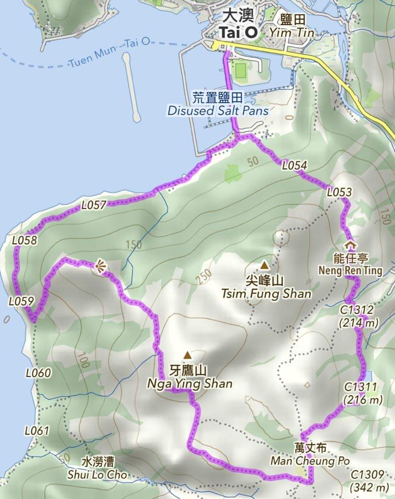
Route 7:Tai O Fishing
A relatively easy route. Don’t forget to enjoy the peaceful vibe, street foods and coffee shops of Tai O fishermen’s village.
Distance:8KM
Elevation:350M
Difficulty:✭✭
Route GPX:https://bit.ly/3dYmNaX
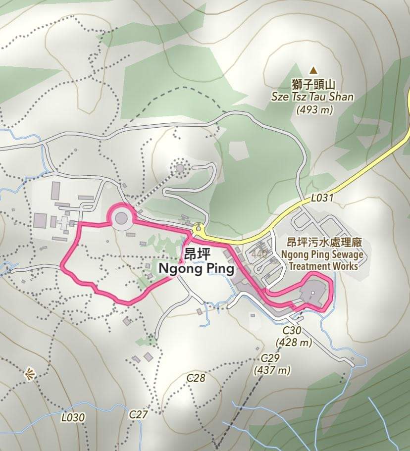
Route 8:Buddha Tadpole
The Buddha Tadpole offers the little ones a small route to go around the Buddha statue and to visit the Ngong Ping Market.
Distance:2KM
Elevation:20M
Difficulty:✭
Route GPX:https://bit.ly/2FQdcGC
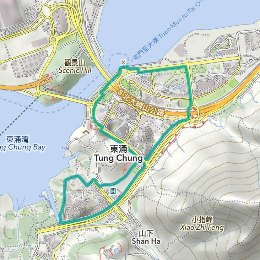
Route 9:Tung Chung Pufferfish
Not a hill person? Just prefer flat roads? No problem. You can still enjoy the event and views of Lantau, try jogging around Tung Chung City.
Distance:6KM
Elevation:none
Difficulty:✭
Route GPX:https://bit.ly/3dUt7QQ
